Heavy rain, gusty winds and severe thunderstorms will impact the southeastern United States through the end of the week.
Heavy rain, gusty winds and severe thunderstorms will impact the southeastern United States through the end of the week.

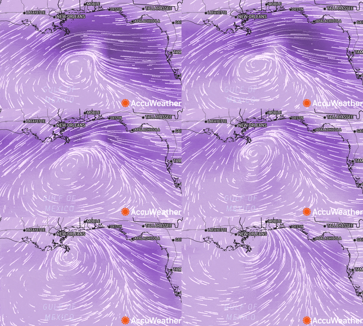
A strengthening storm spinning over the northern Gulf of Mexico will fall short of becoming a tropical system, but AccuWeather meteorologists maintain that heavy rain, gusty winds and severe thunderstorms will impact the southeastern United States through the end of the week.
Rain, thunderstorms and winds were gathering over the northern and eastern Gulf of Mexico Wednesday in response to a southward dip in the jet stream that has broken off from the main part of the river of air high in the atmosphere. The rain, thunderstorms and increasing winds will overspread much of the Southeastern states over the next couple of days.
The storm will not have enough time to evolve into a tropical system, as water temperatures are too low to allow a quick transformation. However, this system will gain strength as it moves from the Gulf to across parts of Florida, Georgia and the Carolinas into Friday evening.

The rain can be heavy enough to lead to some flooding problems, mainly in urban areas from Florida, westward to southeastern Louisiana and northward to the Carolinas as the storm moves along.

“The storm is likely to bring a general 0.75 of an inch to 1.50 inches of rain in this swath, but locally higher amounts will occur,” AccuWeather Meteorologist Jeffrey Nordeen said. Portions of southeastern Louisiana and the Florida Peninsula may pick up 3-6 inches of rain from Wednesday midday to Friday evening.
Prior to the storm’s formation, a stalled front contributed to torrential downpours and localized flooding in parts of South Florida. About 3-6 inches of rain fell around the Miami area from Monday to Wednesday morning.
“From near Miami to perhaps as far north as West Palm Beach, Florida, is one of those spots that could have some issues with localized flooding into Wednesday evening,” AccuWeather Chief On-Air Meteorologist Bernie Rayno said. “Another stretch that may have urban flooding issues extends from New Orleans to Tallahassee, Florida, from Wednesday afternoon to Wednesday night.”

A storm this past Friday and Saturday soaked a large area from Alabama to Georgia and the Carolinas with 1-3 inches of rain and brought challenges for golfers competing in the Masters Tournament at Augusta National Golf Course in Georgia.
Winds will not be as strong as a tropical storm, which can have sustained winds ranging from 39 mph to 73 mph. However, stiff breezes of 15-25 mph with higher gusts near the coast are likely.

“The combination of the heavy rain and strengthening winds into Friday with an already wet soil could bring trees down and lead to localized power outages and property damage,” AccuWeather Meteorologist Mary Gilbert said.
Where winds blow onshore for several hours or more along the northeast Gulf and southern Atlantic coasts, surf conditions will be rough, with coastal flooding at times of the high tide.

Rain with embedded thunderstorms will overspread the Atlanta area later Thursday and may linger into Friday night. Most of the weekend will be free of rain, but thunderstorms may roll on Sunday, forecasters say.
The storm system will have a few other tricks up its sleeve that are similar to a tropical system.
“Strong to severe thunderstorms cannot be ruled out on Thursday for portions of Alabama, Georgia and Florida,” Gilbert said. “A few brief tornadoes and/or waterspouts are also not out of the question.”
The storm system is not all bad news for parts of the Southeast, however.
“While rounds of downpours this week can lead to localized flooding, any rain that falls will ultimately work to negate ongoing drought conditions along the Gulf and southern Atlantic coasts,” Gilbert said.
Prior to the storm from last Friday to Saturday, abnormally dry long-term conditions existed across coastal portions of Louisiana, Mississippi and Alabama, as well as parts of the Carolinas, according to the United States Drought Monitor. Much of the Florida Peninsula was in severe drought. The newest drought monitor report, scheduled to be released Thursday, April 13, could show potential improvement in these areas due to last week’s storm.

The storm’s next stop will be in the Northeast during this upcoming weekend, as it will affect the mid-Atlantic Saturday and then New England Sunday.
The storm can bring localized downpours and a stiff breeze for a time in coastal areas of the Northeast. While the rain may not be welcomed by those with outdoor plans, it may help alleviate the increasing brush fire threat following dry and warm conditions much of this week.
On Sunday, the Gulf storm’s moisture will merge with a potent storm set to produce severe weather in the Mississippi Valley. As a result, parts of the mid-Atlantic could have rain both days of the weekend.
Produced in association with AccuWeather

